
Geospy AI
Visit- Introduction:
Advanced photo geolocation and intelligence analysis made simple.
- Added on:
Sep 06 2024
- Company:
GeoSpy Technologies
Photo Geolocation
Intelligence Analysis
Security Tools
Hey, give Geospy AI alternative a quick try!
GeoSpy AI: Advanced Photo Geolocation and Intelligence Tools
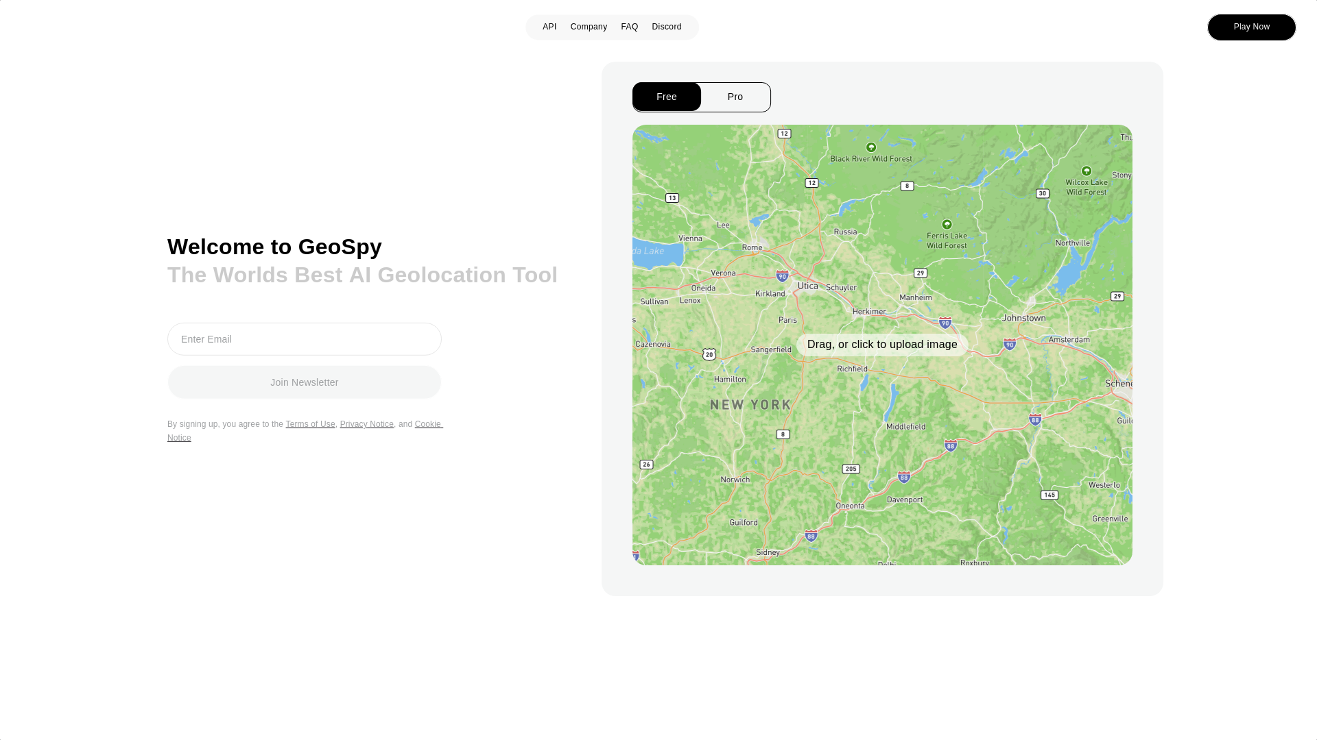
GeoSpy AI is a cutting-edge platform designed to help users accurately determine the geographic location of images using advanced photo analysis tools. Ideal for professionals in security, research, and investigative fields, GeoSpy AI offers precision geolocation, intelligent data processing, and seamless integration with other platforms through its robust API. With a focus on speed and accuracy, GeoSpy AI provides a modern, user-friendly interface for quickly identifying the origins of visual data.
Key Functions of GeoSpy AI
Photo Geolocation
Example
A journalist uploads a photo from a news story to identify its location.
Scenario
This feature helps journalists and investigators locate where an image was taken, even when no metadata is available.
Intelligence Analysis
Example
A security team analyzes images from surveillance cameras for actionable intelligence.
Scenario
GeoSpy AI can identify potential locations of interest or patterns in images to support law enforcement or private investigation efforts.
API Integration
Example
A developer integrates GeoSpy AI’s API into a custom application for large-scale image analysis.
Scenario
Businesses can enhance their own platforms by integrating GeoSpy AI’s geolocation capabilities for seamless data processing and analysis.
Who Should Use GeoSpy AI?
Journalists and Investigators
GeoSpy AI is perfect for journalists and investigators who need to determine where specific images were captured, helping them validate sources and gather location-based intelligence.
Security Professionals
Security professionals benefit from GeoSpy AI’s precision geolocation and intelligence analysis features, helping them track and analyze images from various sources.
Developers and Businesses
Developers and businesses can use GeoSpy AI’s API to integrate powerful photo geolocation features into their own platforms, enhancing functionality and providing location-based insights.
Visit Over Time
- Monthly Visits348,964
- Avg.Visit Duration00:01:01
- Page per Visit2.16
- Bounce Rate51.70%
Geography
- United States14.15%
- China10.31%
- United Kingdom7.43%
- Canada7.29%
- France6.52%
Traffic Sources
How to Use GeoSpy AI
- 1
Upload Image
Users simply upload an image from their device or source to start the geolocation process.
- 2
Analyze Location
GeoSpy AI quickly analyzes the image and determines its geographic location, providing detailed information on the likely origin.
- 3
Use Results
Users can export the geolocation data or integrate it into their workflow, whether for research, security, or business purposes.
Frequently Asked Questions
Geospy AI Pricing
For the latest pricing, please visit this link:https://geospy.ai/pricing
Basic Plan
$9/month or $90/year
Access to basic geolocation tools
Limited monthly image uploads
Email support
Pro Plan
$29/month or $290/year
Unlimited image uploads
Advanced geolocation features
Priority support
API access
Enterprise Plan
Custom pricing
All Pro Plan features
Custom API integrations
Dedicated account manager
Enhanced security protocols